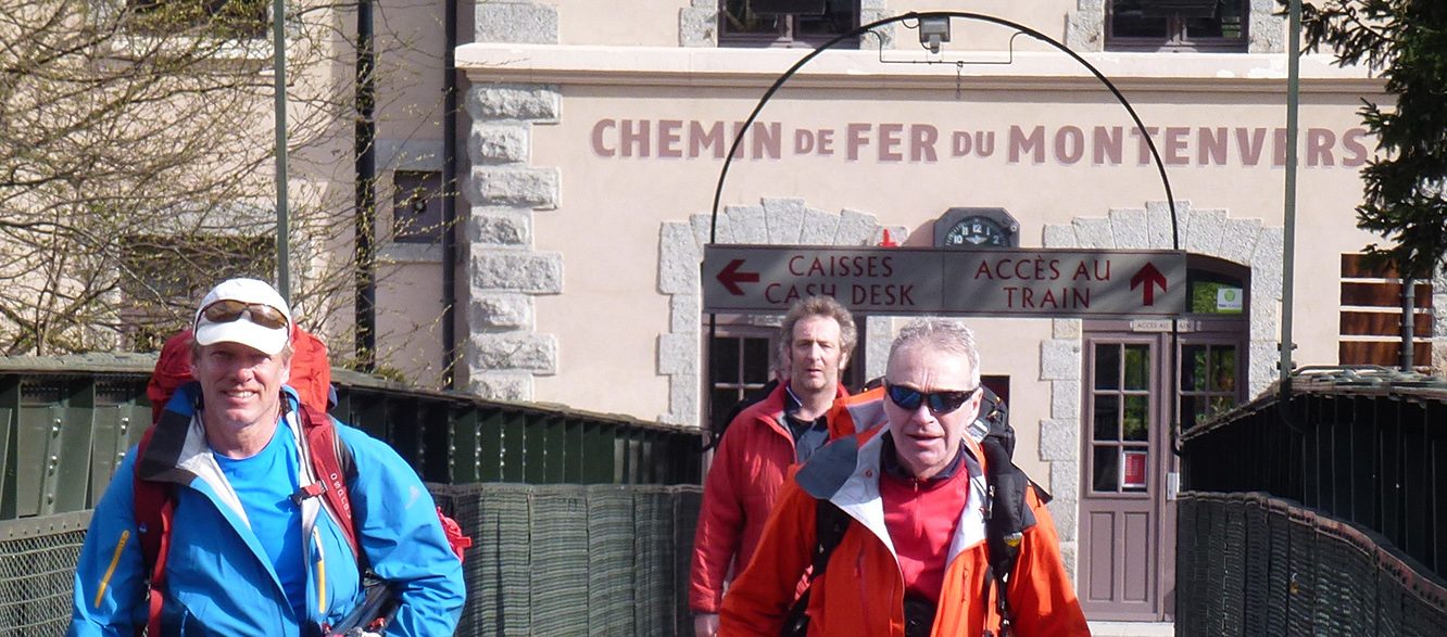
Chamonix Alpine
Dates
3-6day programs
Price
Contact us for a quote
Group Size
Skill Level
Chamonix Alpine
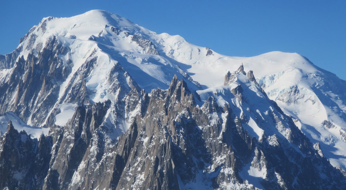
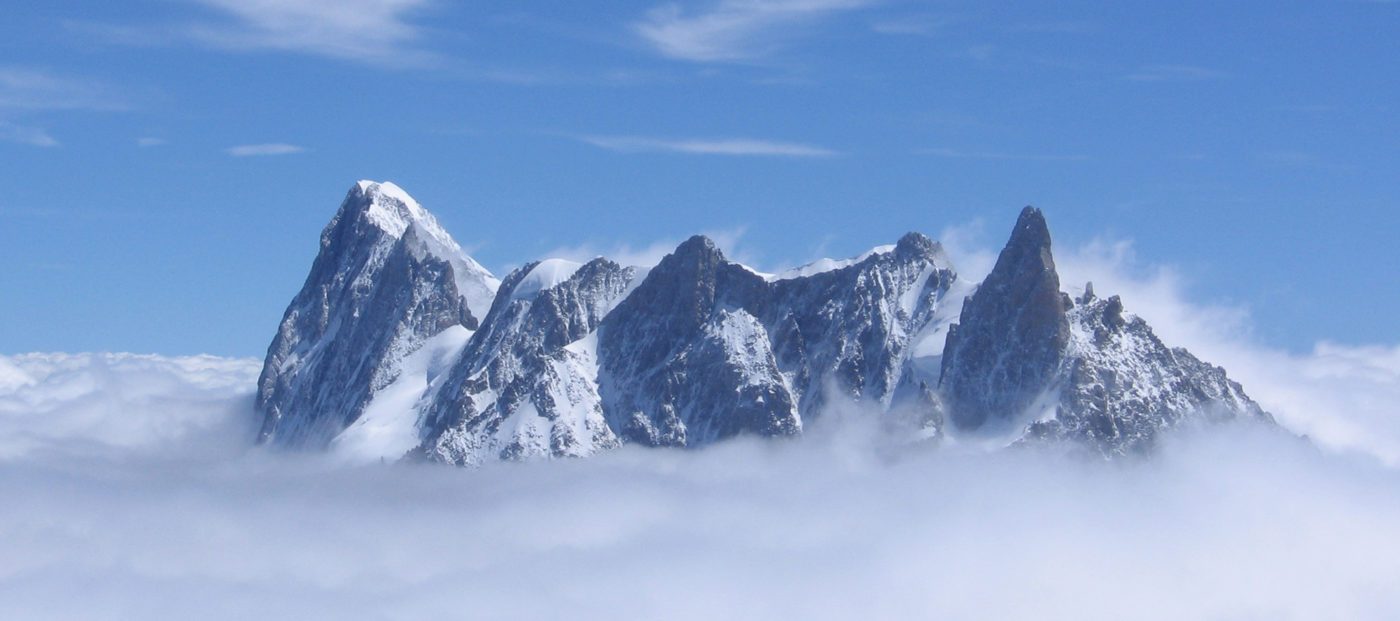
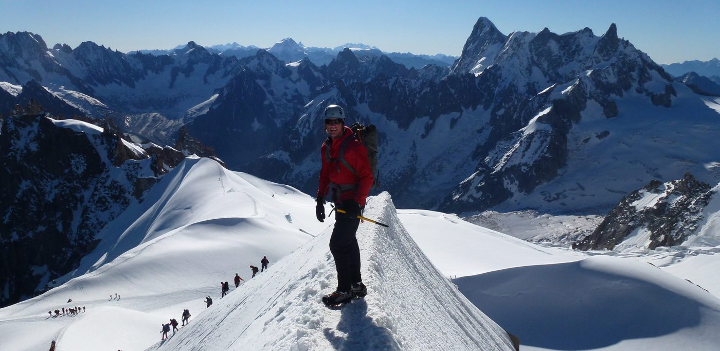
The birthplace of Mountaineering and deservedly the worlds greatest alpine playground...
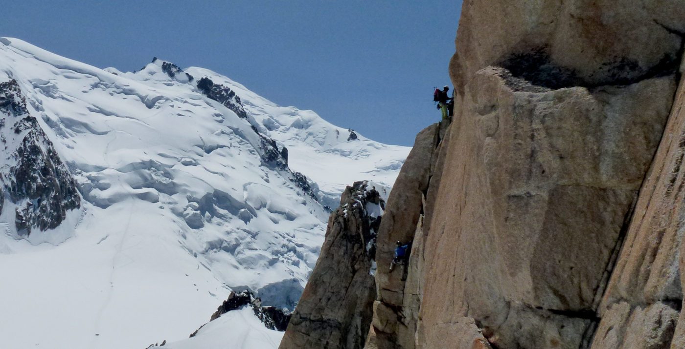
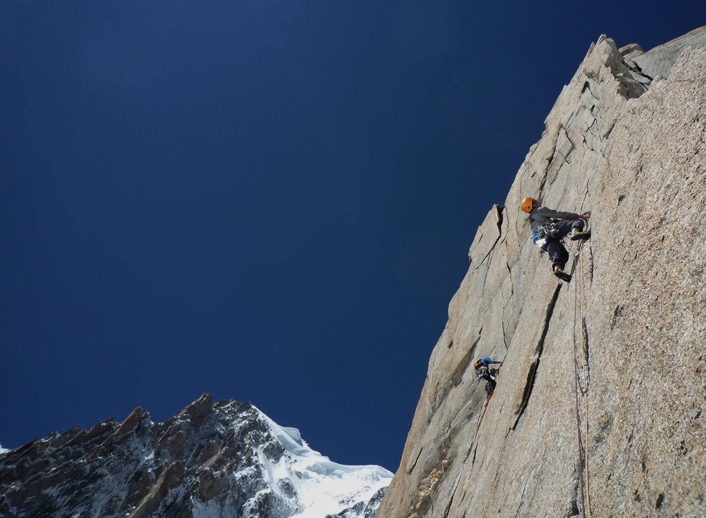
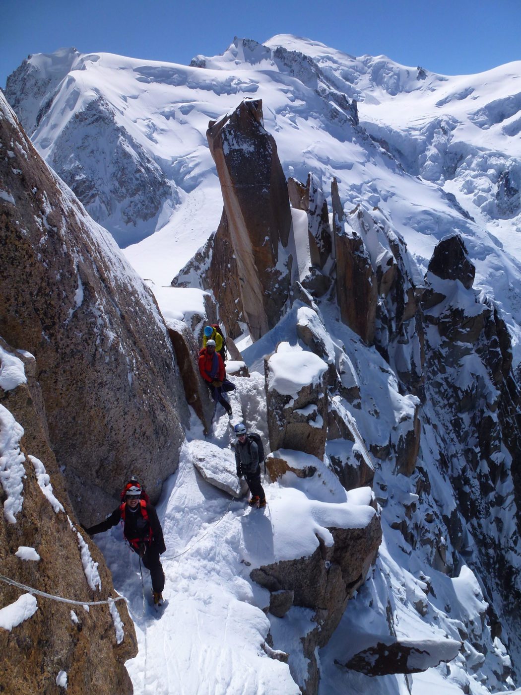
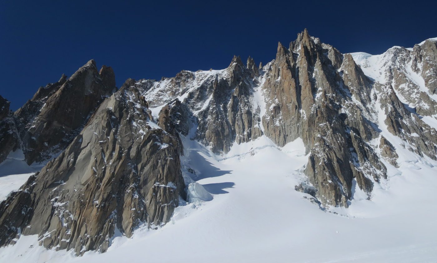
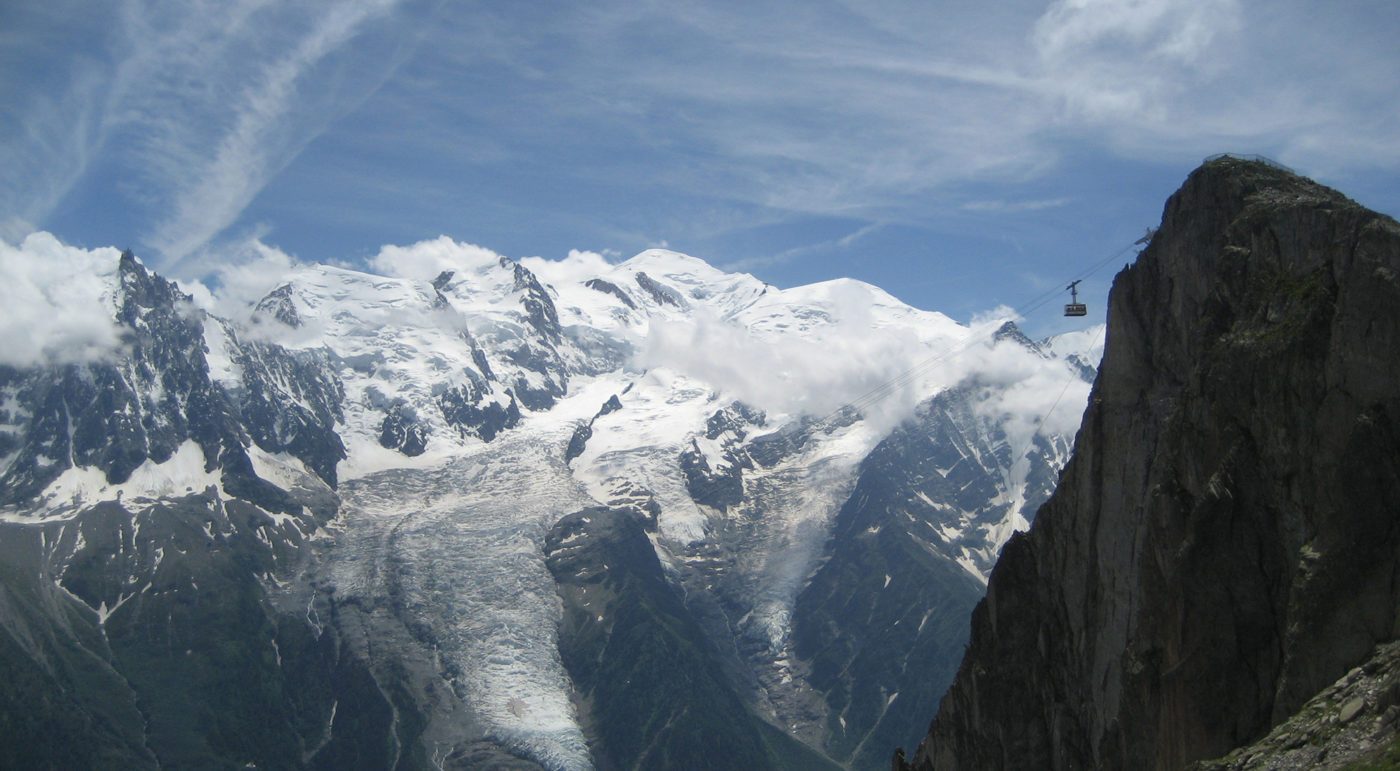
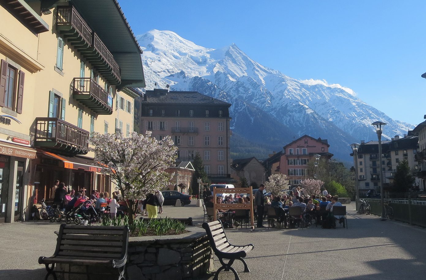
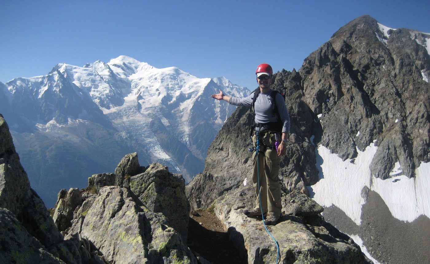
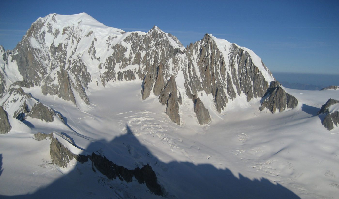
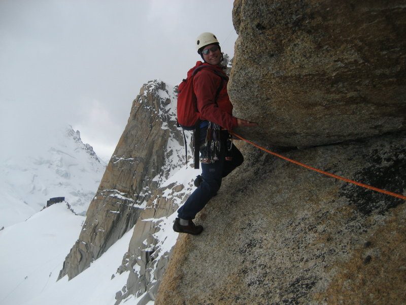
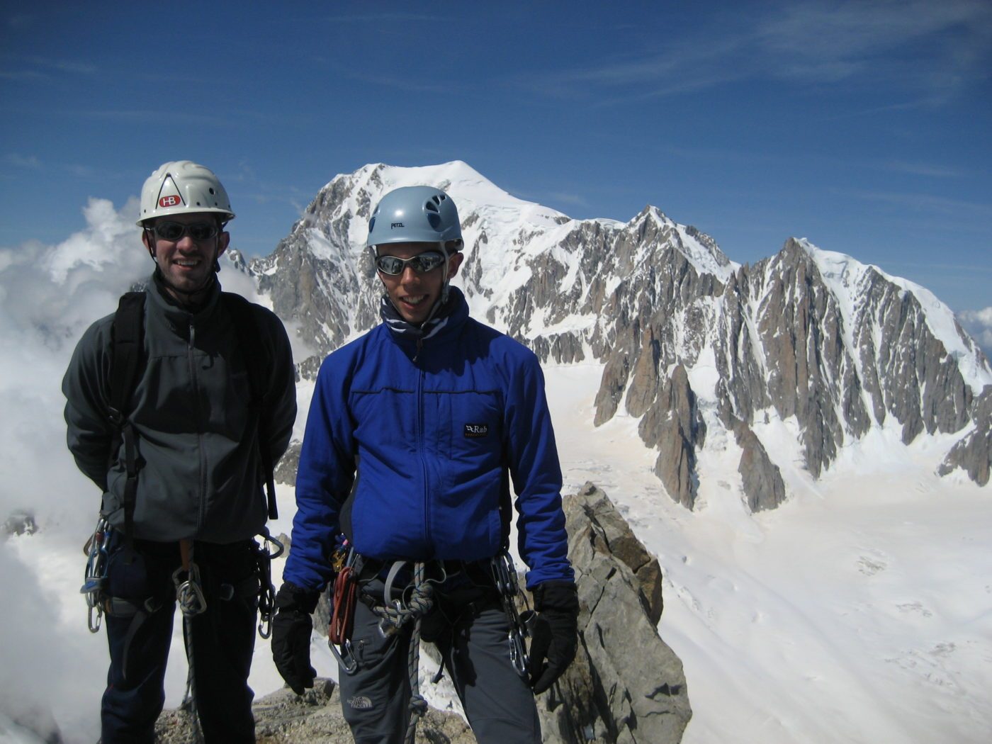
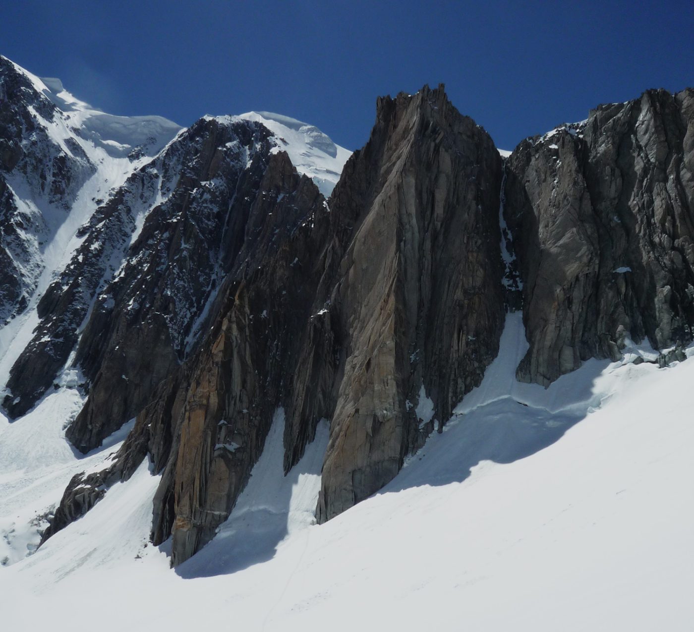
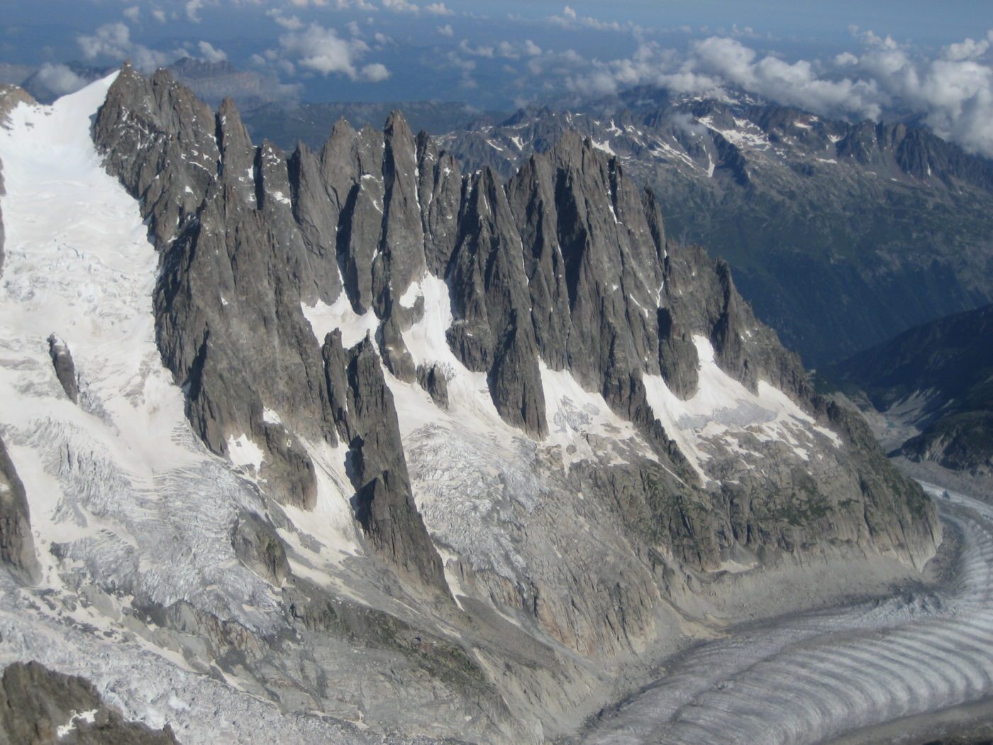
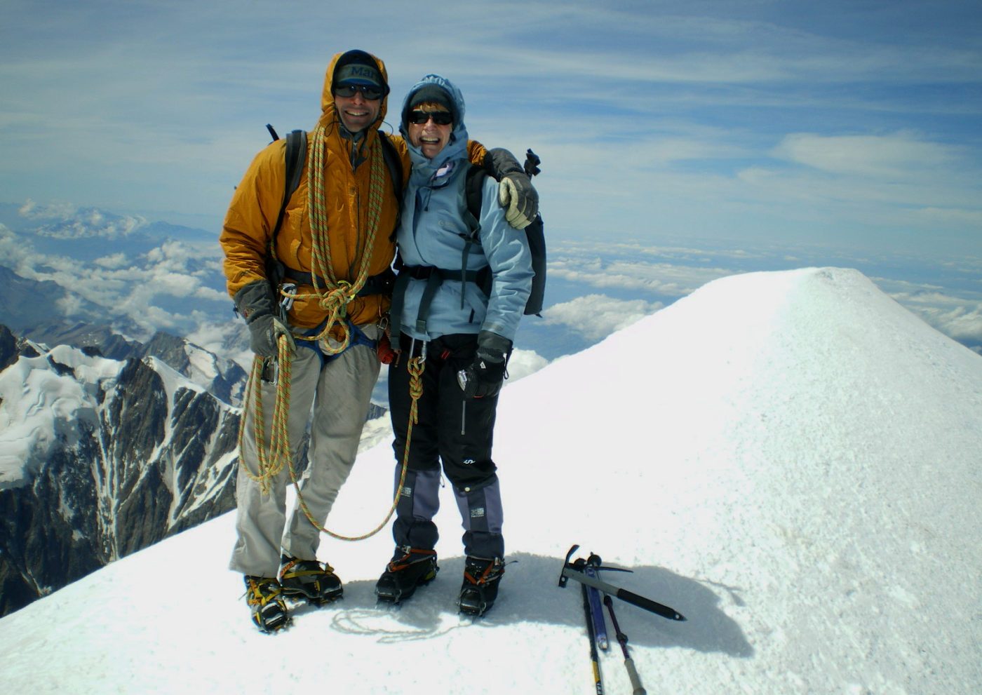
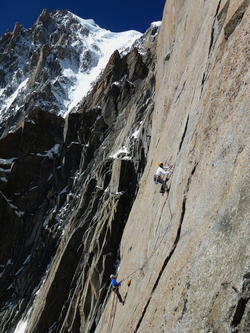
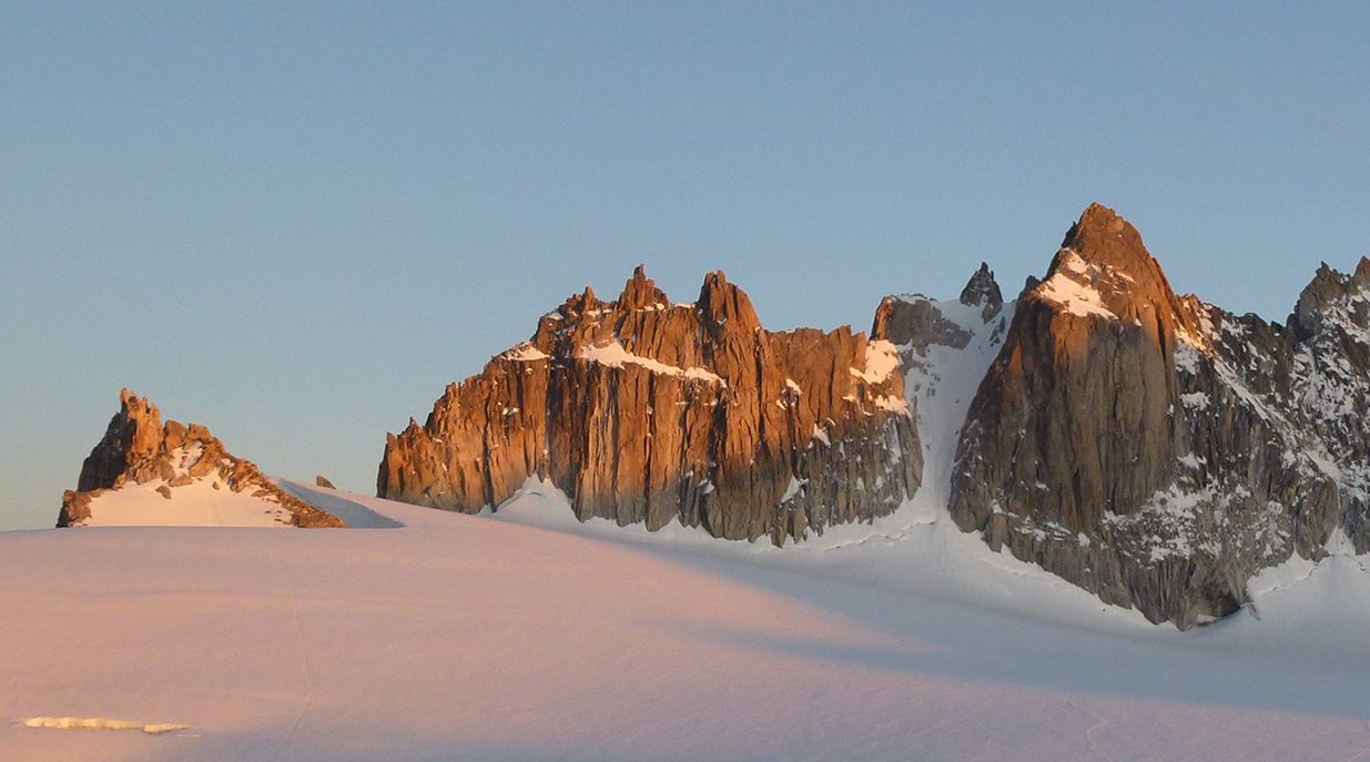
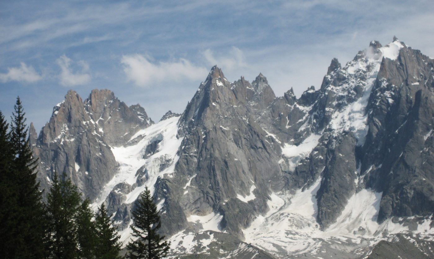
The Chamonix valley is dominated by the majestic dome of Mont Blanc. It is surrounded by hundreds of easily accessible pointy granite spires providing world-renowned rock, ice, and mixed alpine routes. The village is charming and offers incredible vistas, cuisine along with a vibrant mountain culture.
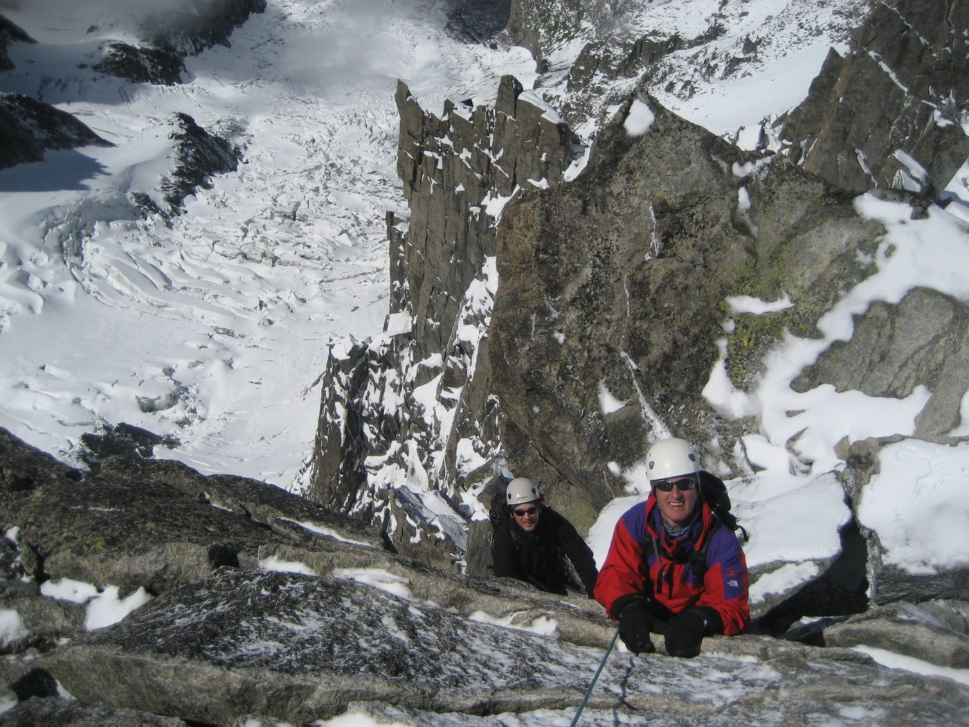
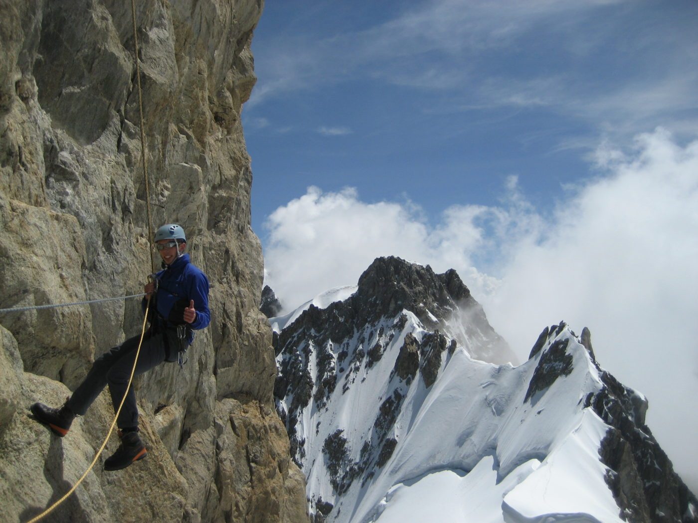
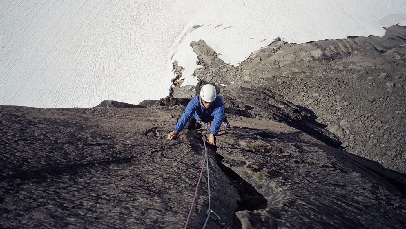
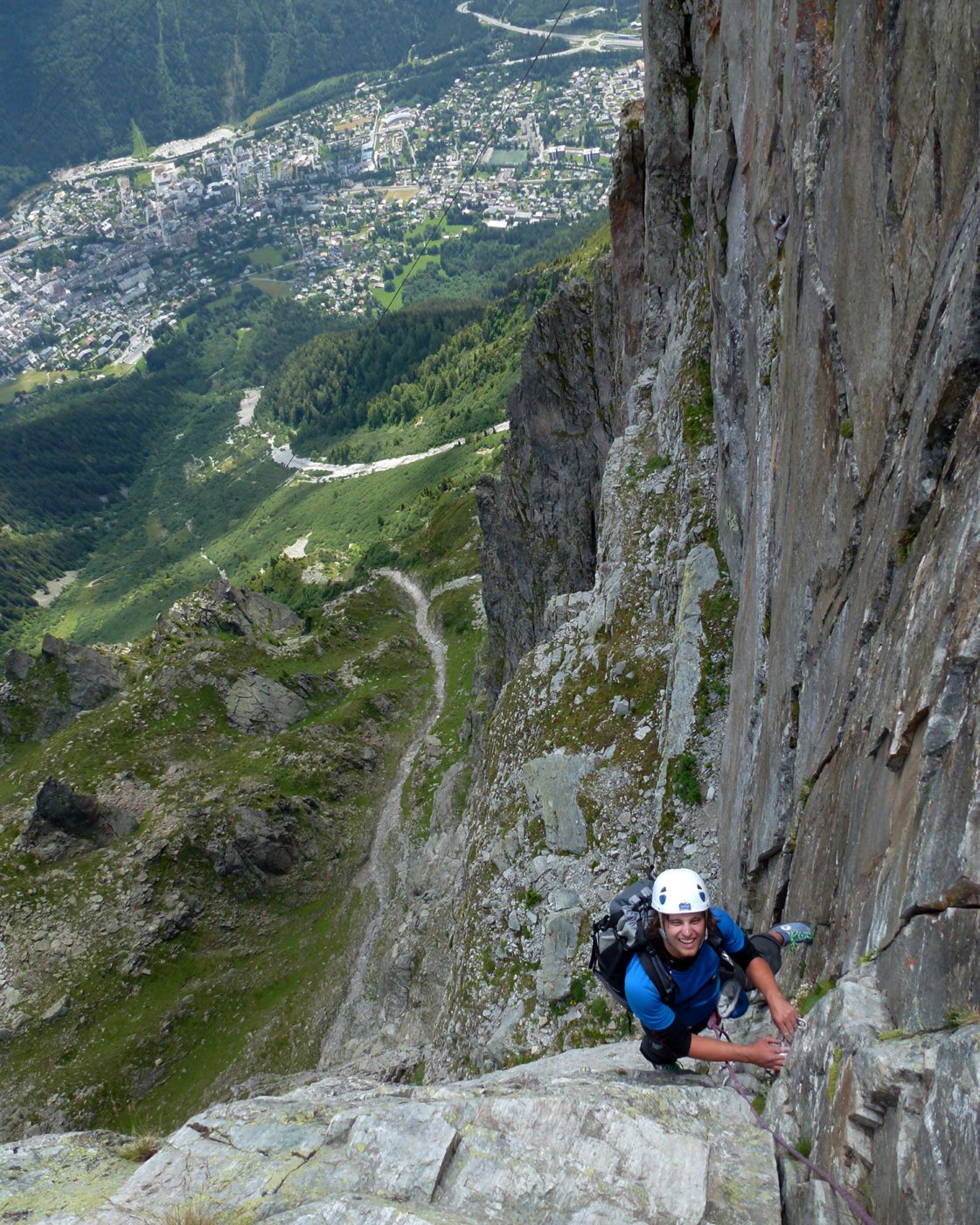
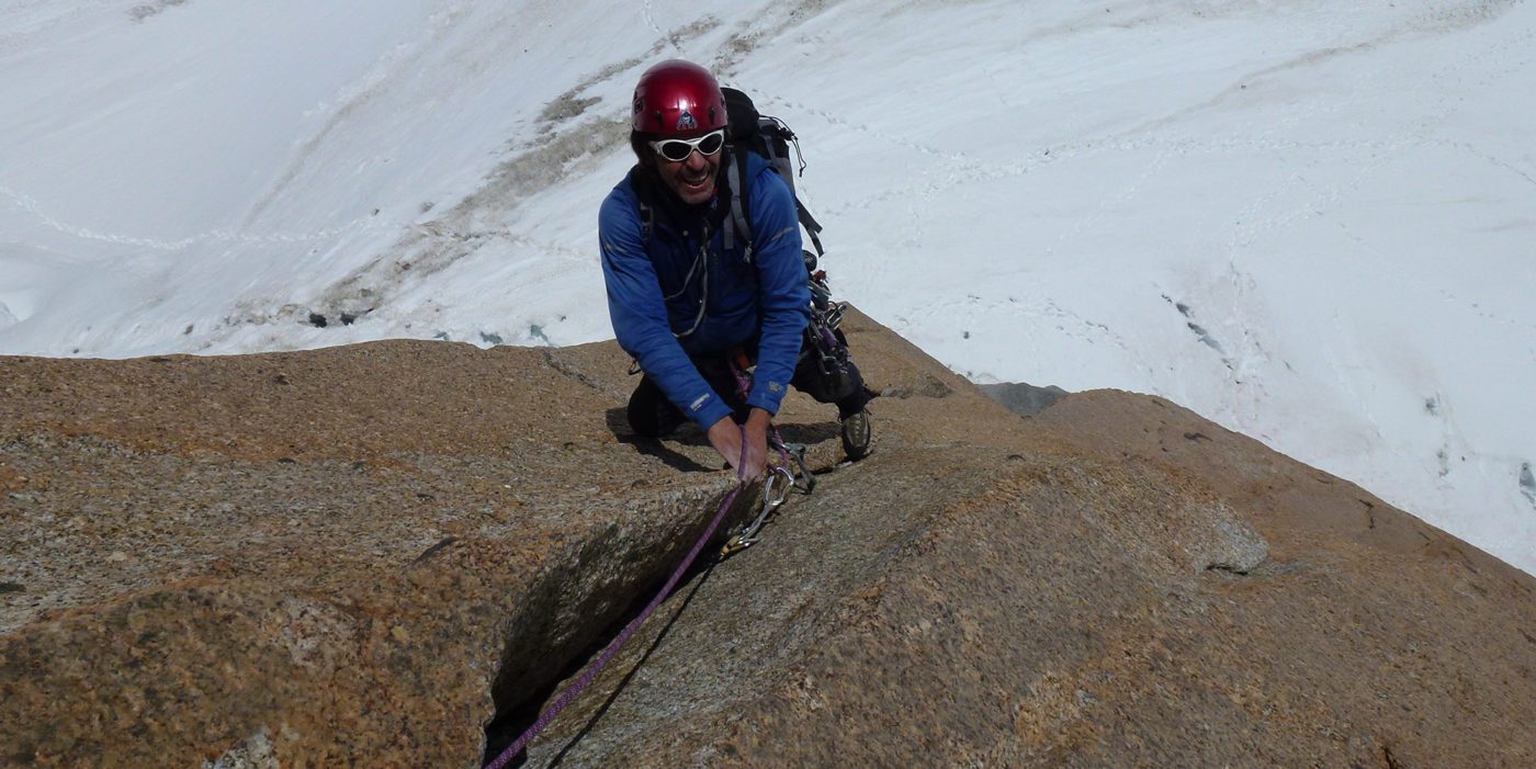
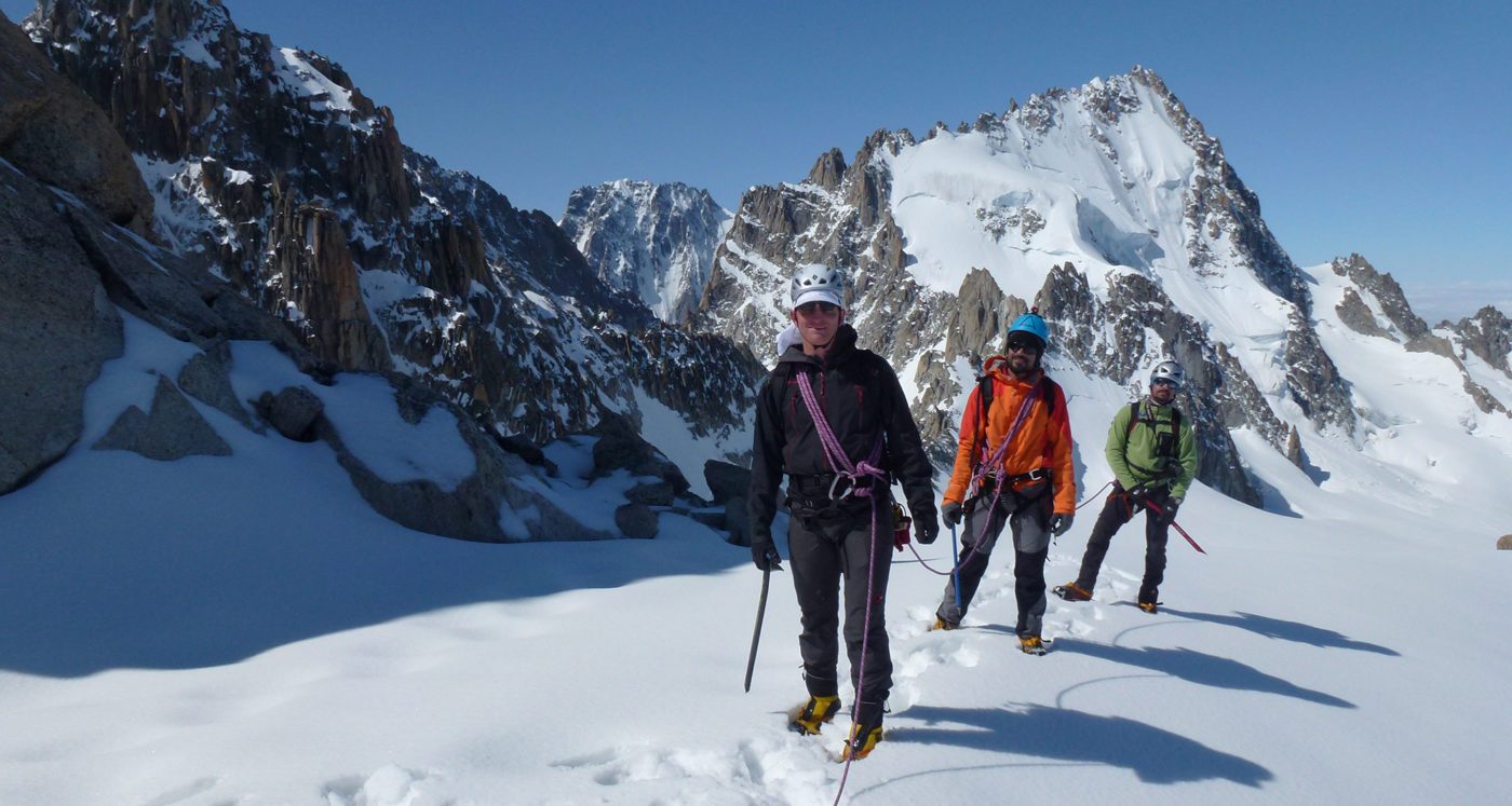
Like most mountaineering in the Alps, climbing in Chamonix provides the luxury of easy access routes with lighter packs and overnight programs based from catered mountain huts. Whether you are interested in an easy alpine route for the day or seek a multi-day adventure from a hut, let us design a unique trip to meet your climbing goals and background.
There are more than a lifetime worth of route options & objectives in the Mont Blanc Massif. Our custom alpine programs in Chamonix range from 3-6 days. Some of the popular peaks and routes we recommend include:
- Aiguille du Midi: Arête des Cosmiques (PD+, 5.6) & South Face (AD, 5.10a)
- Dent du Géant: The South West Face (AD, 5.9)
- l’Index: Southeast Ridge (PD, 5.6)
- Brévent: La Frison-Roche (TD-, 5.10a, 200m)
- Grand Capucin: Swiss Route (TD+, 5.10-)
- Les Courtes: The Traverse (AD), Pente Nord-Est (AD, 700m) & North Face (TD-, 75deg)
- Mont Blanc: Arête des Bosses & Les Trois Monts (both PD)
- Mont Blanc du Tacul: Chéré Couloir (AD-, WI4-)
- Aiguille d’Argentiere: La Flèche Rousse (AD, 5.4)
- Aiguilles Dorées: The Traverse (AD+, 5.7)
For a complete list along with difficulty information, route description and trip length, click on Location below. Please contact us if you are interested in a specific route or a custom trip.
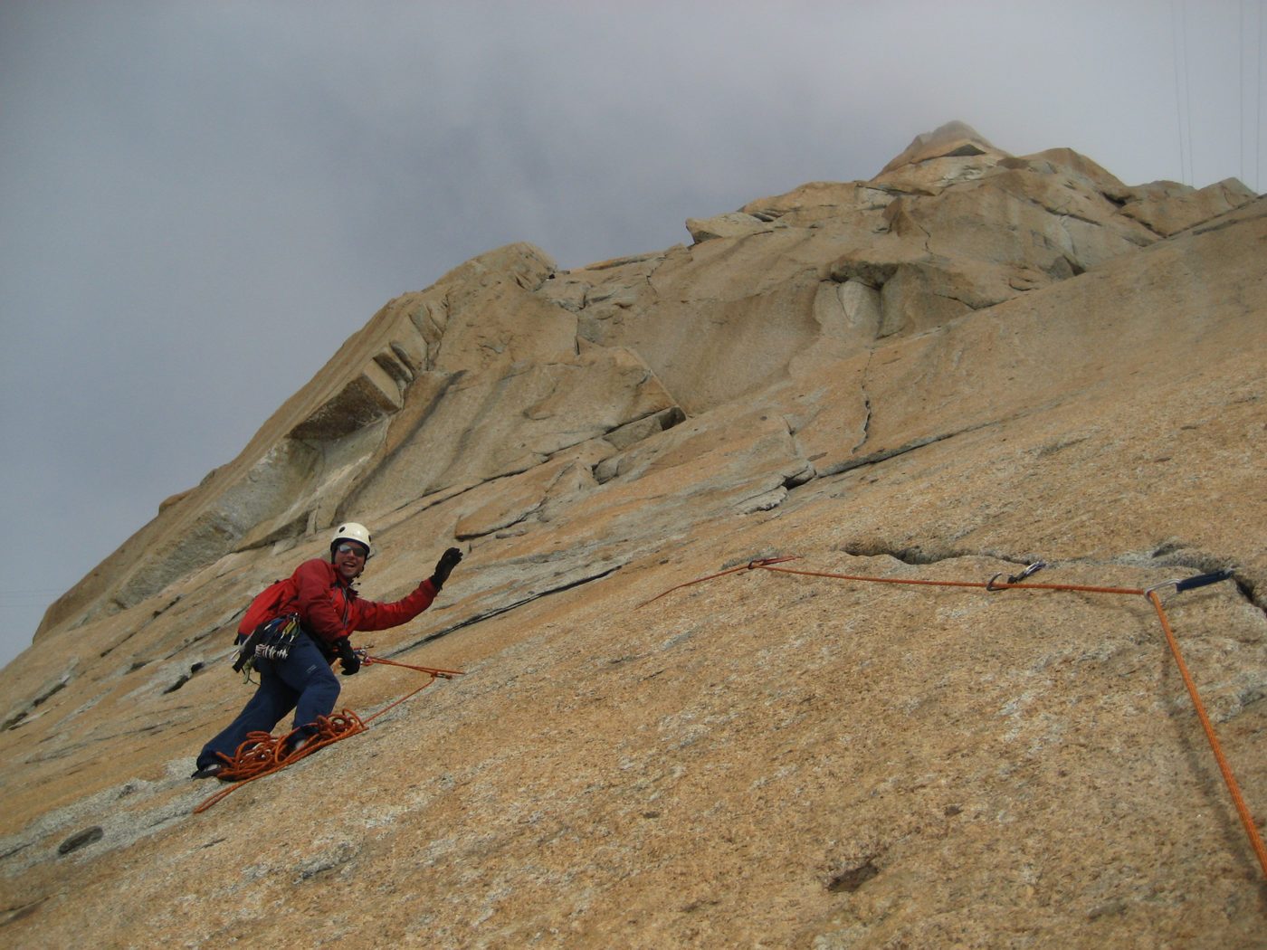
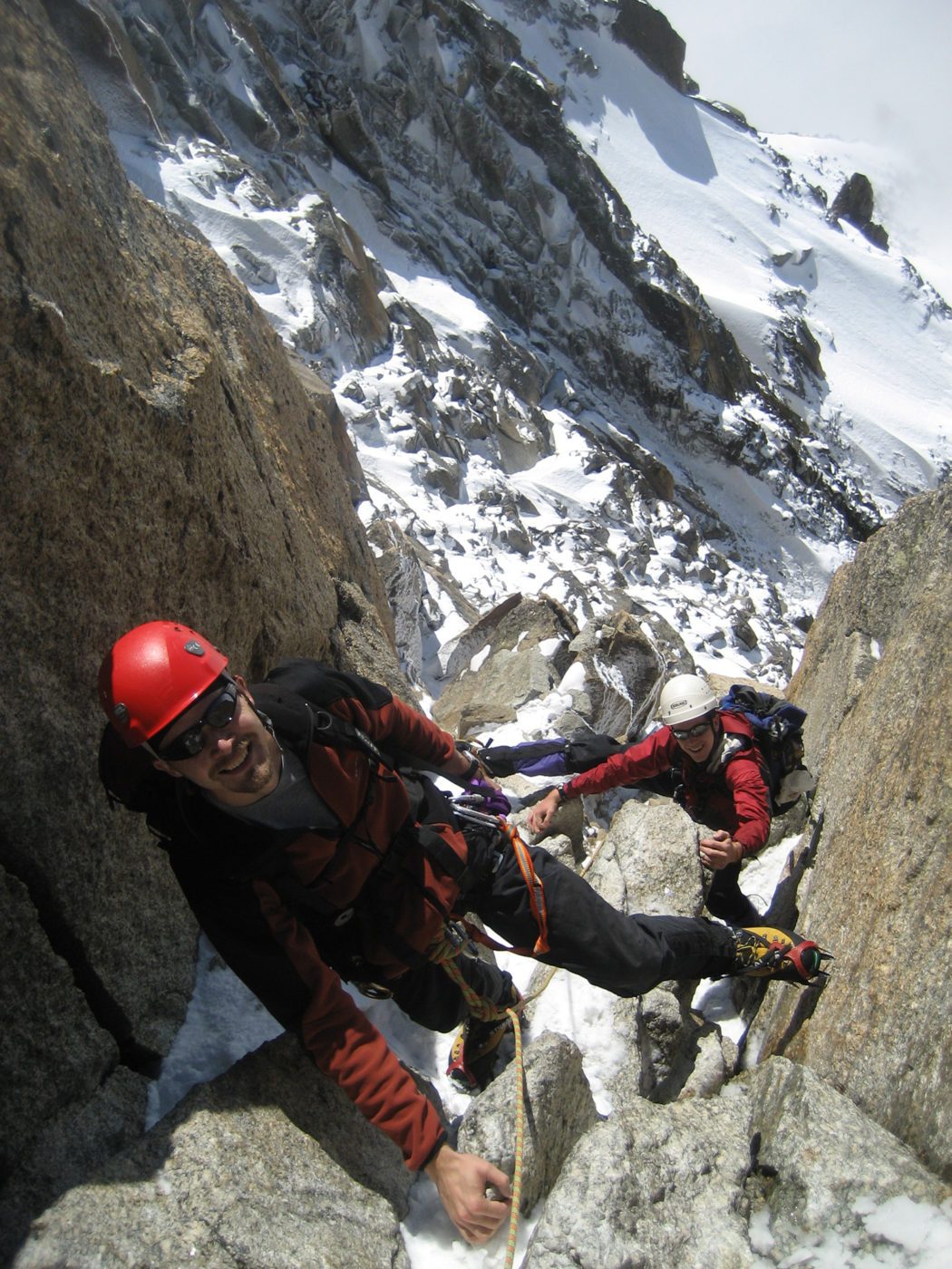
We offer 3-6 day Chamonix Alpine climbing programs. The length and itinerary of this program is flexible and depends on many factors including your interests, needs, and previous climbing experience.
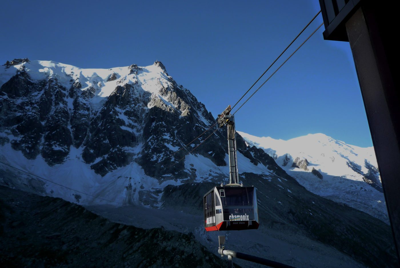
The difficulty and length of a chosen route(s) will often determine the number of days on this program. Chamonix benefits from an efficient lifts network facilitating access to hundreds of classic alpine climbs. Due to the ease of access, it is possible to do many of the routes in one day and be based out of town. Also, there are many conveniently located mountain huts in the Mont Blanc Massif to base out of for the longer routes.
Below is a sample itinerary for a 3-day program
Pre-trip meeting; 17:30 PM in Chamonix (1 hour)
- Welcome, introduction, goals & agenda, waivers.
- Review of planned itinerary and current conditions
- Issue of required gear and session on packing strategy
Day 1, First Tram, Hike-in and Climb
- 06:00 AM, meeting at lift station & head on up
- 06:30 AM, Gear up for glacier travel & hike-in to climb
- Climb, climb, climb!
- 15:30 PM, top out, walk off & hike back to lift station
- 16:30 PM, Back in Chamonix for a great dinner
Day 2, Full Climbing day & overnight at mountain hut
- 06:00 AM, meeting at lift station & head on up
- 06:30 AM, Gear up for glacier travel & hike-in to climb
- Climb, climb, climb!
- 15:30 PM, top out, walk off & hike back to a mountain hut
- 16:30 PM, Back at the hut for a civilized night in the mountain
Day 3, Last climb & tram back to Chamonix
- 05:00 AM, breakfast, hike-in to another classic alpine route
- 07:30 AM, start climbing
- Climb, climb, climb!
- 16:30 PM, top out, walk off & head back to lift station
- 20:00 PM, back in Chamonix for a well deserved shower & dinner
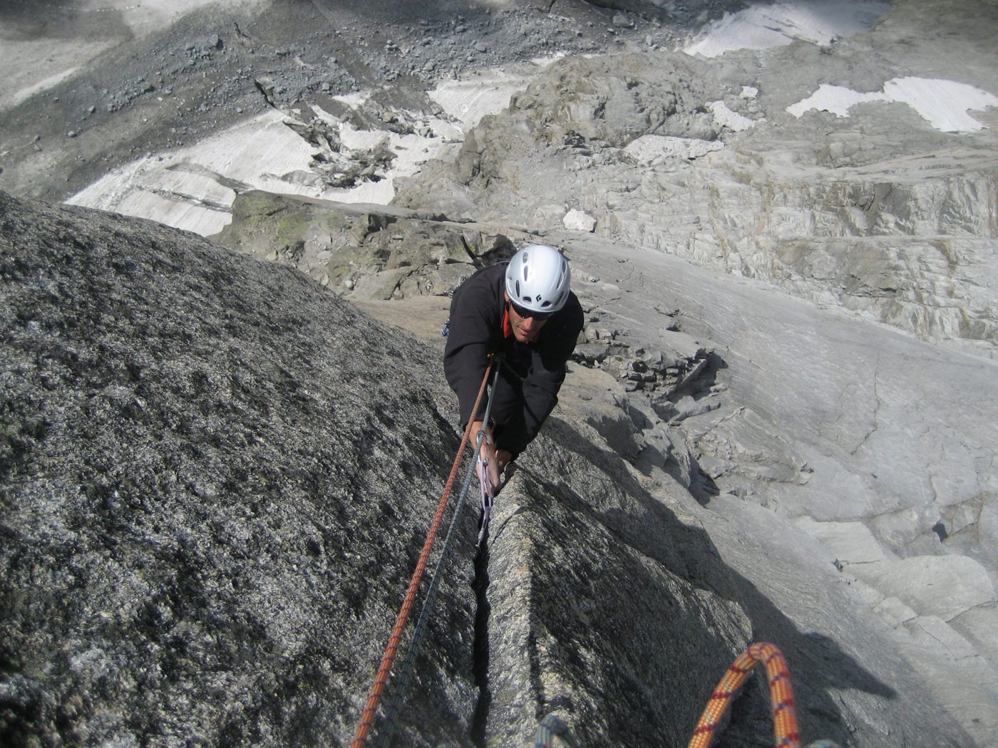
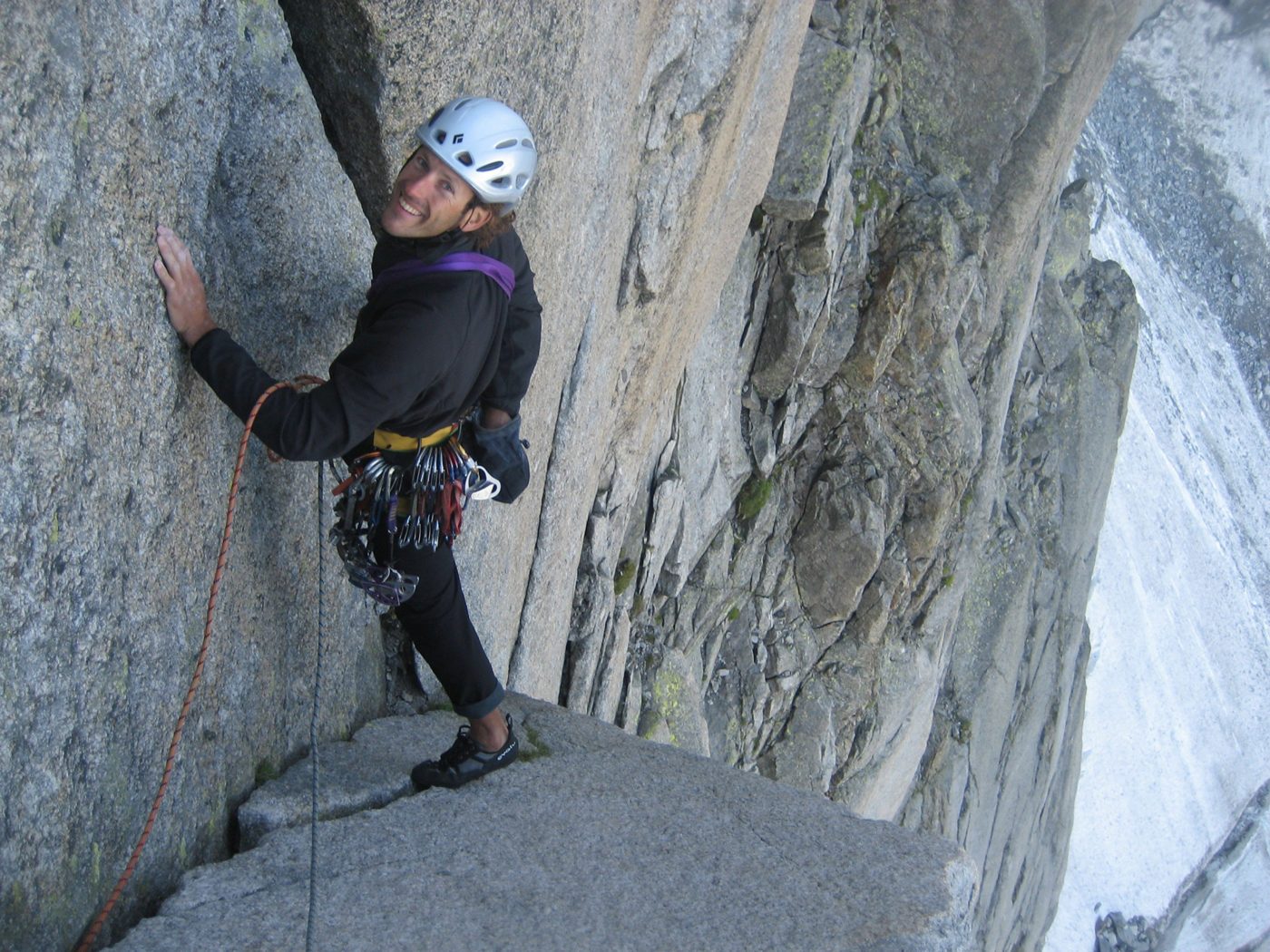
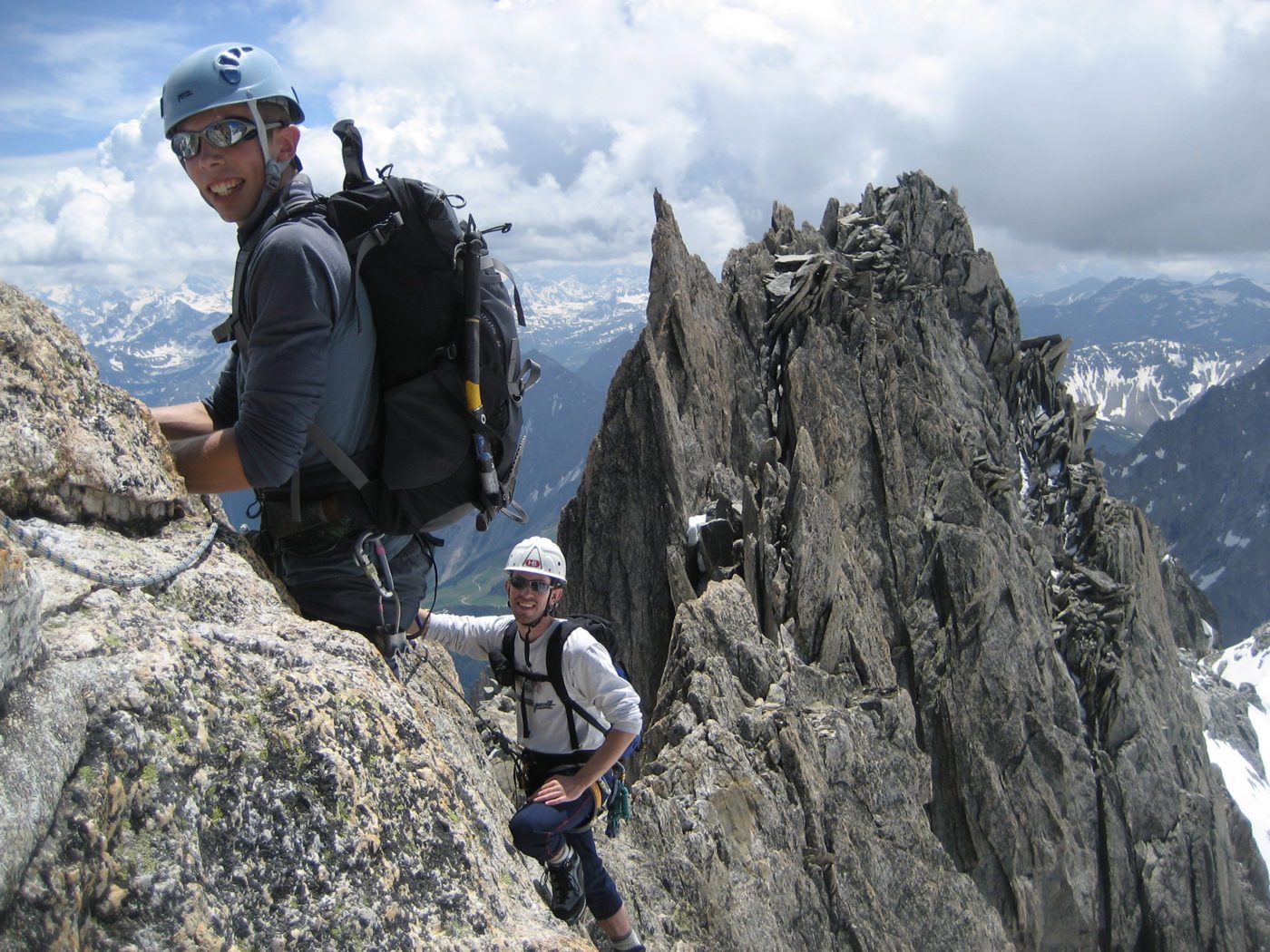
On this guided alpine rock program, prior rock climbing and mountaineering experience is required. Good physical fitness is also a must as it will give us the ability to move safely and efficiently in the mountains. The difficulty of the routes we attempt will be based on your personal goals, interests and previous climbing experience. Previous traditional and crack climbing experience, with or without a guide and the ability to climb with a small pack is required.
Located in the Western Alps, the village of Chamonix is deeply nestled near the headwaters of the Arve river in Eastern France. It is very close to the border with both Switzerland and Italy. It is best accessed from the Geneva international airport, 70 km away, via public or private transfers. Private transfers take about 1 hour and can be arranged through various companies, see FAQ below for details. Public transfers by train or bus are also possible. They are slightly more affordable however in the case of the train, connections are not ideal and it takes upwards of 2.5 hours to reach Chamonix. The bus is quicker, more direct and just as economical as the train.
Here is a list of our favorite Chamonix peaks
- Mont Blanc, 4808m / 15775’
- Mont Maudit, 4465m / 14650’
- Mont Blanc du Tacul, 4248m / 13940’
- Aiguille du Midi, 3842m / 12600’
- Aiguille du Plan, 3673m / 12050’
- Aiguille des Grands Chamoz, 3445m / 11302’
- Grandes Jorasses, 4208m / 13805’
- Dent du Géant, 4013m / 13170’
- Aiguille d’Entrèves, 3600m / 11810’
- La Tour Ronde, 3800m / 12470’
- Aiguille du Chardonnet, 3824m / 12545’
- Aiguille d’Argentière, 3900m / 12795’
- Aiguilles Dorées, 3519m / 11545’
- Aiguille du Tour, 3544m / 11630’
- Mont Dolent, 3823m / 12540’
- Les Courtes, 3856m / 12650’
- Les Droites, 3944m / 12940’
- Aiguille Verte, 4122m / 13520’
- Le Grand Dru, 3754m / 12316’
- Aiguille du Moine, 3412m / 11200’
Our favorite Chamonix alpine routes grouped by areas
Trient-Argentière Area
- Aiguille d’Argentière: Glacier du Milieux (PD+, 40-45deg, 1150m)Arête de Flèche Rousse (AD, 4b, 450m), Arête du Génépi (D, 5B, 200m), Arête du Jardin (D, 4c, 900m)
- Mont Dolent: Arête Gallet (AD+, 40-50deg, 1150m), Voie normale (PD+)
- Aiguille du Chardonnet; Arête Forbes (AD, 3b, 50deg.), Éperon Migot (AD+, 55deg, 500m)
- Aiguille du Tour : Arête de la Table intégrale (AD, 4c, 45deg, 400m), Voie normale (F, 35deg, 100m)
- Tête Blanche-Petite Fourche, Traversée (AD, 55deg, 120m)
- Aiguilles Dorées, Arête sud (D+, 5c, 400m), Traversée (D-, 6a, 250m)
- Les Ecandies, Traversée (D, 5c, 150m)
Glacier Nant, Charpoua, Talfère & Leschaux Area
- Les Drus; Traversée (D, 5c, 500m), Voie Contamine (TD+, 6b, 650m)
- Aiguille Verte ; Arête du Moine (AD+, 3.c, 45deg, 700m), Arête des Grands Montets (D, 4c, 55deg, 900m), Arête du Jardin (D-, 4b, 50deg, 650m), Couloir Whymper (AD+, 50deg, 600m)
- Aiguille du Moine; Arête sud (D, 5c, 400-600m), Voie normale (PD, 3c, 400m)
- Les Droites; Eperon Tournier direct (TD+, 5c, 80deg, 1200m)
- Les Courtes; Pente nord-est (AD, 45-50deg, 750m), Traversée (AD, 45deg, 200m)
- Pointe Isabella; Voie normale (PD+, 35deg, 1100m)
- Aiguille de Savoie; Arête Preuss (AD+,4c, 450m)
- Aiguille Pierre à Joseph; Voie Comte (D+, 5c, 300m)
- Petites Jorasses, Arête sud (D, 5c, 400m)
- Grandes Jorasses; Arête de Tronchey (TD-, 4c, 50deg, 950m), Arête des Hirondelles (D, 5c+, 700m), Eperon Walker (ED-, 6a, 90deg, 1200m), Voie normale (AD, 50deg, 1400m)
Glacier du Géant Area
- Aiguille de Rochefort; Arêtes en aller-retour (AD, 3b, 45deg, 600m)
- Dent du Géant; Voie normale (D-, 5c, 200m)
- Aiguilles Marbrées; Traversée (PD II, 55deg, 200m)
- Aiguille d’Entrèves; Traversée (AD-, 5a, 100m)
- Tour Ronde; Arête sud-est (AD, 45deg, 200m), Couloir Gervasutti (AD, 50deg, 300m), Face nord (D-, 60deg, 350m)
Aiguilles de Chamonix
- Aiguille de l’M; Arête nord-est (D-, 5b, 180m), Voie Couzy (TD-, 6a, 250m), Voie Ménégaux (TD+ 6b, 200m)
- Petits Charmoz; Traversée (AD, 4b, 170m), voie normale (PD, 2c, 250m
- Aiguille des Grands Charmoz; Pilier Cordier (TD-, 5c, 650m)
- Aiguille du Grépon, Versant Mer de Glace (D 5c, 800m)
- Aiguille de Blaitière; Nabot Léon (TD- 6a, 180m), L’eau rance d’Arabie (TD+ 6b, 250m)
- Aiguille du Plan; Ryan-Lochmatter (D+ 4c, 550m), Traversée Midi-Plan (AD, 40deg, 200m)
- Aiguille du Midi; Arête des Cosmiques (AD, 4a, 240m), Eperon des Cosmiques (D+ 6a, 120m), Eperon Frendo (D 5c, 80deg, 1200m), Face Sud (TD 6a, 200m)
- Aiguille du Peigne; Voie normale (AD 4b, 600m), Arête des Papillons (D 6a, 640m
- Aiguille des Pélerins; Grütter Ridge (D+ 5c, 220m)
Envers des Aiguilles
- Tour Rouge, Le Marchand de Sable (TD+ 6a+, 280m),
- Bec d’Oiseau, Arête sud-est/Voie Pascal Meyer (TD+ 6a, 600m)
- Pointe des Nantillons, Bienvenue au Georges V (TD+ 6a+, 350m)
- Dent du Requin, Arête du Chapeau à Cornes (AD+ 4c, 600m), Congo Star (TD 6a+, 300m), Renaudie (D 5c, 600m)
Les Trois Mont Blanc
- Mont Blanc; Traversée ou Voie Normale (PD+, 35 à 50deg, 1600m-2500m, 2-3 days), Grand Pilier d’Angle (TD+, 4+, 90deg, 1500m, 1-2 days), Innominata Ridge (D+ 5b, 50deg, 1000m, 2-3 days), Intégrale de Peuterey (D, 4c, 50deg, 2500m, 3 days)
- Traversée Royale : Miage/Bionnassay/Mont-Blanc (AD 3c, 40deg, 4000m, 3-4 days)
- Mont Maudit; Voie normale (PD+, 45deg, 1000m), Arête Küffner (D, 50deg, 900m)
- Mont-Blanc du Tacul, Goulotte Chéré (D, WI4, M3, 85deg, 700m), Pilier Gervasutti (TD, 6a, 900m), Triangle du Tacul via la Contamine-Grisolle (AD, 60deg, 700m), Voie normale (PD, 35-45deg, 700m), Chandelle du Tacul via la Bonatti-Tabou (TD, 6b+, 200m)
- Grand Capucin, Voie des Suisses (ED- 6b, 300m)
- Pointe Adolphe Rey; Bettembourg-Thivierge (TD+ 6b, 200m), Salluard (TD- 6a, 300m)
- Roi de Siam, Le Lifting du Roi (D+ 5c, 200m)
- Pyramide du Tacul, Arête est (D- 5a, 250m)
- Pointes Lachenal; Traversée (AD- 4a, 100m), Voie Contamine (TD 6a+, 250m)
- Aiguille Noire de Peuterey, Arête sud (TD 5c, 1100m)
- Aiguille Croux, Voie Ottoz (TD- 5c, 350m)
- Dômes de Miage, Traversée (PD, 40deg, 1150m)
Aiguilles Rouges
- Brévent, La Frison-Roche (TD- 6a, 200m), Poème à Lou (TD+ 6c, 250m), La Somone (D- 5a, 200m)
- Clocher du Brévent; Crakoukass (TD- 6b, 250m)
- Clocher de Planpraz; Traversée Clocher-Clocheton (AD+ 5a, 400m), Cocher-Cochon (TD- 6a, 400m)
- Chapelle de la Index; Arête sud (D- 5a, 350m)
- Contreforts de l’Index; Nez rouge (D- 5b, 175m), Mani Puliti (D 5b, 175m)
- Aiguille de la Floria; Asia (D+ 5c+, 210m)
- Col des Crochues, Gaspard 1er (D 5c, 160m)
- Aiguilles Crochues, Traversée (PD 3c, 200m), Voie Ravanel (D+ 6a, 340m)
- Aiguille du Belvédère, Voie normale (PD, 35deg, 200m)
- Aiguille du Pouce; Voie des dalles (TD- 5c, 400m), Voie des Français (TD+ 6a, 350m),
- Aiguille de Praz-Torrent; Voie Parat-Seigneur (TD- 6a, 150m)
- Aiguillette d’Argentière (cool Pilar), Chéserys (slab route), Le Buet, Barberine, Grandes voies
Many other easy, moderate and advanced route options exist, contact us for more information. To create our favorites list we have considered these factors: length of the route, technical difficulty, how to sustain a route is and how long of a day it takes to complete it.
Understanding the French Alpine Grades
F: Facile/Easy. These routes involve easy glacier travel and may require some rock scrambling. Except for the glacier sections, you can often climb ropeless.
PD: Peu Difficile/a little difficult. These routes involve some technical climbing sections and glaciers of higher difficulty. There may also be some short sections of steep terrain. They are good introductory climbs for beginners.
AD: Assez Difficile/fairly hard. These are physically demanding routes for experienced alpine climbers. They usually have steep and exposed climbing sections or snow/ice slopes over 50°. The descents are long and more complicated, and most of the route requires to be roped.
D: Difficile/difficult. These routes involve sustained rock climbing, ice climbing or snow travel. They are considered a significant undertaking and demand a huge commitment.
TD: Très Difficile/very difficult. Highly technical climbs that involve long distances, remote locations, and hard multi-pitch climbing sections. Besides, there are often other hazards like bad weather (extreme cold, strong winds) or poor protection on the routes.
ED: Extremement Difficile/extremely difficult. These are extreme climbs (the most difficult in the world, actually!) with continuous difficulties. They take several days to be completed.
ABO: Abominablement difficile (Abominable). This category is reserved for the most impossible and dangerous climbs.
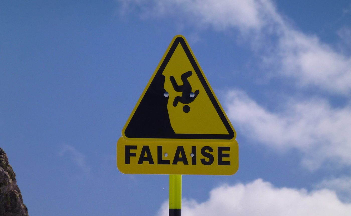
Due to the higher elevations, proximity to dominant winds and weather conditions, mountain weather is difficult to predict. It is most often worse than the weather in the surrounding valleys and can change quickly as it is really hard to predict for more than 24hrs ahead.
In summer you expect temperatures to be from 10 C to 28C in the day while overnight temperature can drop dramatically in the high alpine, even below zero. Temperatures are much colder at higher elevations, even in the summer. It is not uncommon to have overnight freezing temperatures in the alpine, outside a mountain hut or near a backcountry camp.
It is always an interesting challenge to know exactly what you are going to get, therefore is important to be flexible with timing and not too attached to a particular goal or objective. Be prepared by bringing all required items, this ensures you will be dressed for all variations as temperatures, wind, precipitation.
- Pre-trip planning support
- Fully certified IFMGA and/or ACMG Alpine Guide or Mountain Guide services
- 15 years of experience in the area
- Alternative plan based on current conditions
- Rope use & all technical equipment
- Emergency response plan
Services NOT included:
- Dinners & breakfast meals on trip, available at mountain huts or in town
- Lift passes
- Personal clothing, equipment, climbing/mountaineering boots *see equipment list for more details
- Personal lunch & snacks
- Travel to meeting location or taxis for shuttles
- Accommodation or huts on trip
- Gratuities
- Trip interruption, cancellation insurance or medical insurance
- Additional costs incurred if changes made to itinerary due to weather
Getting to Chamonix?
Chamonix is located in the Alps of eastern France. It is very close to the border with both Switzerland and Italy. It is best accessed from the Geneva international airport, 70 km away, via public or private transfers. Private transfers take about 1 hour and can be arranged through these companies:
Public transfers by train or bus are also possible. They are slightly more affordable however in the case of the train, connections are not ideal and it takes upwards of 2.5 hours to reach Chamonix.
How experienced do I need to be?
On this guided alpine rock program, prior rock climbing and mountaineering experience is required. Good physical fitness is also a must as it will give us the ability to move safely and efficiently in the mountains. The difficulty of the routes we attempt will be based on your personal goals, interests and previous climbing experience. Previous traditional and crack climbing experience, with or without a guide and the ability to climb with a small pack is required.
Is it safe?
On all our courses, SMG provides you with fully certified IFMGA/ACMG Mountain, alpine and rock guides. This guarantees you the highest safety standards in the industry. Mountaineering remains hazardous and while it is impossible to eliminate all the hazards, our guides will maximize your experience and greatly minimize the risks involved.
Can I rent some of the equipment needed during the programs?
On this program, participants are required to have their own equipment. If needed, some equipment is available for rental. Contact us for details
Where can I rent/buy climbing & outdoor equipment?
There are a number of outdoor stores in the Chamonix region that supply good service and quality outdoor equipment and gear. Here are a few good options:
Snells Sport www.snellsport.com
Au Vieux Campeur www.auvieuxcampeur.fr
