From group management to map, compass, GPS, trip planing & more…
Mountain navigation for recreational hikers or mountain leaders interested in streamlining their navigation and trip planing skills. Learn modern skills for effective navigation, leadership and organization hence reducing hazards and increasing terrain understanding. Our courses are a mix of classroom and outdoor skill practices.
We offer two “building block” type courses. Our Intro to mountain navigation is foundational. It is also a building block for the advanced mountain navigation course we offer. It is possible to go directly into the advanced course providing you have a good understanding or all intro skills. Here is a rough outline of each course:
Intro to Mountain Navigation (4 hours theory, 4 hours practical)
- Welcome, introduction, goals & agenda, waiver.
- Resources outline (devices & web resources)
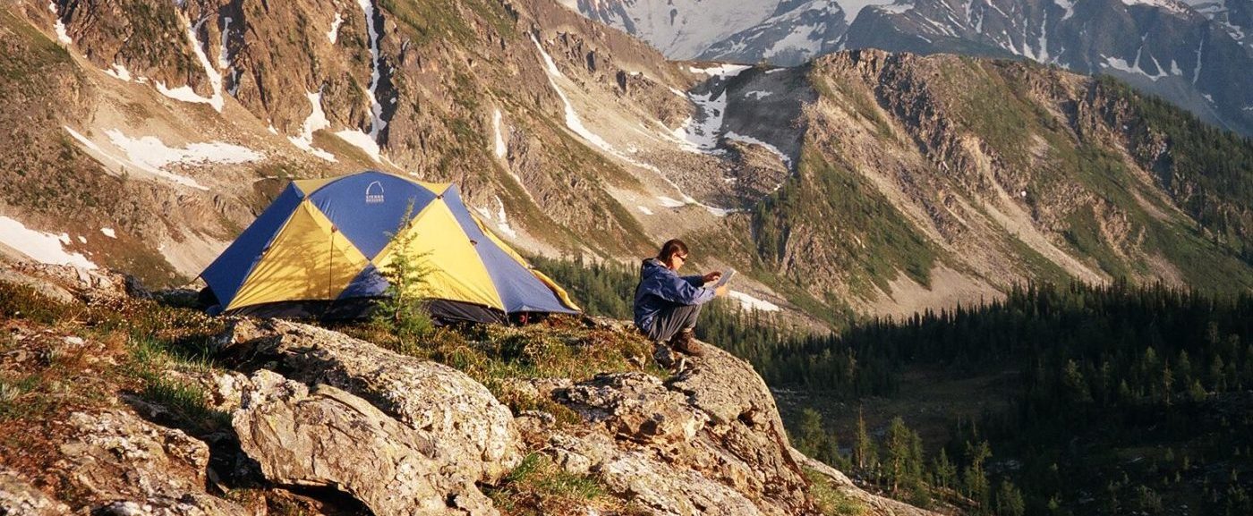
- Map reading, UTM coordinates, Lat/Long
- Map & compass use, terrain classification
- GPS introduction
- field practice, map & compass skills
- hazard recognition & route planning
- Group management introduction
Advanced Mountain Navigation (4 hours theory, 4 hours practical)
- Welcome, introduction, goals & agenda, waiver.
- Review of intro skills
- GPS devices, functions and skills
- Route planing with GPS, Google earth & other programs
- Whiteout Navigation with GPS
- Pros and cons of various devices
- hazard recognition & route planning
- Group management skills
The itinerary depends on exact course location, weather conditions and participants. Courses usually run from 8am to 4:30pm with a 30 min lunch break. See below samples for the intro and advance courses:
Intro to Mountain Navigation (4 hours theory, 4 hours practical)
- Welcome, introduction, goals & agenda, waiver.
- Resources outline (devices & web resources)
- Map reading, UTM coordinates, Lat/Long
- Map & compass use, terrain classification
- GPS introduction
- field practice, map & compass skills
- hazard recognition & route planning
- Group management introduction
Advanced Mountain Navigation (4 hours theory, 4 hours practical)
- Welcome, introduction, goals & agenda, waiver.
- Review of intro skills
- GPS devices, functions and skills
- Route planing with GPS, Google earth & other programs
- Whiteout Navigation with GPS
- Pros and cons of various devices
- hazard recognition & route planning
- Group management skills
Students are responsible to self evaluate their skills as groups need to be matched together based on prior experience and ability. Please contact us to discuss your background and what kind of course would suit you best.
The intro to mountain navigation is for any experienced hiker interested in understanding basic navigation skills. Possessing maps of the area along with a compass is required.
The advanced navigation course is significantly more in-depth. Participant have completed the intro course or equivalent. Students on the advanced course need a GPS unit and must bring a laptop with downloaded programs to class.
Classroom sessions will be located in Nelson; field day hikes vary depending on weather, conditions and student fitness.
Kootenay weather can vary drastically. In summer you expect temperatures to be from 8 C to 28C in the day while overnight temperature can drop dramatically in the high alpine, even below zero. Visibility could be poor or whiteout conditions when raining heavily or snowing or clear on bluebird days. Ensure you are dressed for all variations as temperatures, wind, precipitation can change within the day.
How experienced do I need to be?
On this navigation program you will learn based on your preparation, goals and fitness. For field portions, good physical fitness will contribute to a comfortable learning experience.
Is it safe?
On all hike programs, we provide you with fully certified IFMGA / ACMG Mountain, alpine and hiking guides. This gives you the highest safety standards in the industry. While it is impossible to eliminate all the hazards, our guides will maximize your experience and greatly minimize the risks involved.
What course materials do I need?
Ensure you have a notebook, a working compass, a map of the area and all personal equipment for day trip.
Where can I rent/buy climbing & outdoor equipment?
Here are a few outdoor stores in the West Kootenays that supply good service and quality outdoor equipment and gear rental, please ensure you rent gear well in advance.
Rivers Oceans and Mountains www.roamshop.com
Valhalla Pure Outfitters www.shop.vpo.ca